
Mapa topográfico Calispell Peak
Haga clic en el mapa para ver la altitud.
Acerca de este mapa
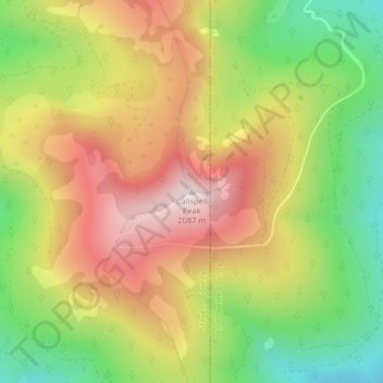
Nombre: Mapa topográfico Calispell Peak, altitud, relieve.
Lugar: Calispell Peak, Stevens County, Washington, United States (48.43680 -117.50251 48.43690 -117.50241)
Altitud media: 1.768 m
Altitud mínima: 1.460 m
Altitud máxima: 2.078 m
Otros mapas topográficos
Haga clic en un mapa para ver su topografía, su altitud y su relieve.