
Mapa topográfico Voyageur Provincial Park
Mapa interactivo
Haga clic en el mapa para ver la altitud.
Acerca de este mapa
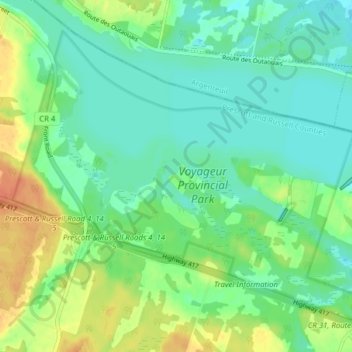
Nombre: Mapa topográfico Voyageur Provincial Park, altitud, relieve.
Altitud media: 46 m
Altitud mínima: 33 m
Altitud máxima: 71 m
Otros mapas topográficos
Haga clic en un mapa para ver su topografía, su altitud y su relieve.
Chute-à-Blondeau
Canada > Ontario > Prescott and Russell Counties > East Hawkesbury
Altitud media: 56 m