
Mapa topográfico Chamoli Gopeshwar
Mapa interactivo
Haga clic en el mapa para ver la altitud.
Acerca de este mapa
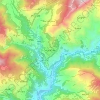
Nombre: Mapa topográfico Chamoli Gopeshwar, altitud, relieve.
Lugar: Chamoli Gopeshwar, Chamoli, Uttarakhand, 246401, India (30.36878 79.27855 30.44878 79.35855)
Altitud media: 1.566 m
Altitud mínima: 895 m
Altitud máxima: 2.725 m
Gopeshwar is located at 30°25′N 79°20′E / 30.42°N 79.33°E / 30.42; 79.33. It has an average elevation of 1,550 m (5,090 ft). Gopeshwar is 8.4 km (5.2 mi) away from Chamoli which is located on the banks of Alaknanda river and along NH 58. Gopeshwar is able to captivate any visitor with its mystic charm and pristine beauty. There are multiple snow-capped hills and peaks visible from Gopeshwar.