
Mapa topográfico Bluebell Lakes
Mapa interactivo
Haga clic en el mapa para ver la altitud.
Acerca de este mapa
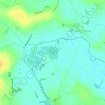
Nombre: Mapa topográfico Bluebell Lakes, altitud, relieve.
Altitud media: 23 m
Altitud mínima: 14 m
Altitud máxima: 41 m
Otros mapas topográficos
Haga clic en un mapa para ver su topografía, su altitud y su relieve.
Bulwick
United Kingdom > England > East Northamptonshire > Deene
Bulwick, Deene, East Northamptonshire, Northamptonshire, East Midlands, England, United Kingdom
Altitud media: 88 m
Willow Brook
United Kingdom > England > East Northamptonshire
Willow Brook, East Northamptonshire, Northamptonshire, East Midlands, England, PE8 6XQ, United Kingdom
Altitud media: 63 m
King's Cliffe
United Kingdom > England > East Northamptonshire
King's Cliffe, East Northamptonshire, Northamptonshire, East Midlands, England, United Kingdom
Altitud media: 69 m