
Mapa topográfico Crowningshield
Mapa interactivo
Haga clic en el mapa para ver la altitud.
Acerca de este mapa
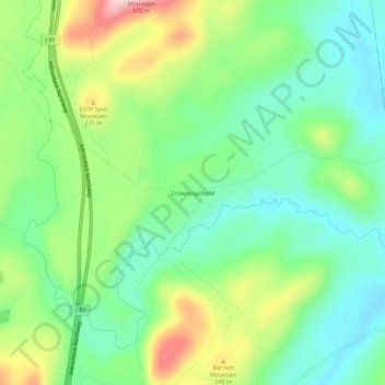
Nombre: Mapa topográfico Crowningshield, altitud, relieve.
Altitud media: 183 m
Altitud mínima: 107 m
Altitud máxima: 326 m
Otros mapas topográficos
Haga clic en un mapa para ver su topografía, su altitud y su relieve.
Deerhead
United States > New York > Essex County > Town of Lewis
Deerhead, Town of Lewis, Essex County, New York, United States
Altitud media: 253 m
Stowersville
United States > New York > Essex County > Town of Lewis
Stowersville, Town of Lewis, Essex County, New York, 12950, United States
Altitud media: 183 m