
Mapa topográfico Kundelungu
Mapa interactivo
Haga clic en el mapa para ver la altitud.
Acerca de este mapa
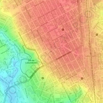
Nombre: Mapa topográfico Kundelungu, altitud, relieve.
Altitud media: 1.243 m
Altitud mínima: 1.199 m
Altitud máxima: 1.262 m
Otros mapas topográficos
Haga clic en un mapa para ver su topografía, su altitud y su relieve.
Météo
Democratic Republic of the Congo > Haut-Katanga > Ville de Lubumbashi > Lubumbashi
Météo, Lubumbashi, Ville de Lubumbashi, Haut-Katanga, Democratic Republic of the Congo
Altitud media: 1.251 m
Lubumbashi
Democratic Republic of the Congo > Haut-Katanga > Ville de Lubumbashi > Lubumbashi
Lubumbashi, Makutano, Lubumbashi, Ville de Lubumbashi, Haut-Katanga, 13, Democratic Republic of the Congo
Altitud media: 1.259 m