
Mapa topográfico Weligama
Mapa interactivo
Haga clic en el mapa para ver la altitud.
Acerca de este mapa
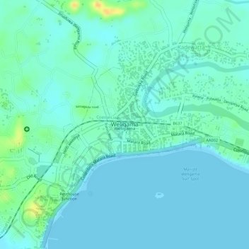
Nombre: Mapa topográfico Weligama, altitud, relieve.
Lugar: Weligama, Matara District, Southern Province, Sri Lanka (5.96910 80.42287 5.98161 80.43598)
Altitud media: 8 m
Altitud mínima: -1 m
Altitud máxima: 31 m
Weligama (Sinhala: වැලිගම, Tamil: வெலிகாமம்) is a town on the south coast of Sri Lanka, located in Matara District, Southern Province, Sri Lanka, governed by an Urban Council. The name Weligama, literally means "sandy village" which refers to the area's sandy sweep bay. It is approximately 144 kilometres (89 mi) south of Colombo and is situated at an elevation of 9 metres (30 ft) above the sea level.