
Mapa topográfico Mombasa
Mapa interactivo
Haga clic en el mapa para ver la altitud.
Mombasa
Being a coastal town, Mombasa is characterised by a flat topography. The town of Mombasa is centred on Mombasa Island, but extends to the mainland. The island is separated from the mainland by two creeks, Port Reitz in the south and Tudor Creek in the north.
Acerca de este mapa
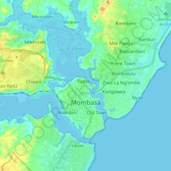
Nombre: Mapa topográfico Mombasa, altitud, relieve.
Lugar: Mombasa, Coastal Kenya, Kenya (-4.08098 39.59569 -3.99304 39.73303)
Altitud media: 18 m
Altitud mínima: -3 m
Altitud máxima: 118 m