
Mapa topográfico Sandia Mountain Wilderness
Mapa interactivo
Haga clic en el mapa para ver la altitud.
Acerca de este mapa
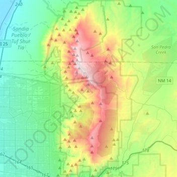
Nombre: Mapa topográfico Sandia Mountain Wilderness, altitud, relieve.
Altitud media: 2.052 m
Altitud mínima: 1.532 m
Altitud máxima: 3.245 m
Some of the most common animals seen in the Sandia Wilderness are mule deer, black bears, raccoons, bobcats, and various species of squirrel. There are also many birds of prey that live and migrate within the Sandia Mountain Wilderness including golden eagles and various species of hawks. Other birds such as roadrunners, Steller's Jays, ravens, and canyon wrens can also be found on in the mountains. The upper parts of the Sandia Mountains have a lot of tree cover made up mostly of firs and spruce trees, with ponderosas and conifers inhabiting the middle elevations.