
Mapa topográfico South Fork - Grapevine Creek
Mapa interactivo
Haga clic en el mapa para ver la altitud.
Acerca de este mapa
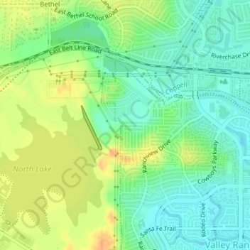
Nombre: Mapa topográfico South Fork - Grapevine Creek, altitud, relieve.
Altitud media: 145 m
Altitud mínima: 130 m
Altitud máxima: 164 m
Otros mapas topográficos
Haga clic en un mapa para ver su topografía, su altitud y su relieve.
Irving
United States > Texas > Dallas County > Irving
Irving, Dallas County, Texas, 75061, United States
Altitud media: 162 m