
Mapa topográfico Herkimer
Mapa interactivo
Haga clic en el mapa para ver la altitud.
Acerca de este mapa
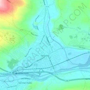
Nombre: Mapa topográfico Herkimer, altitud, relieve.
Altitud media: 154 m
Altitud mínima: 110 m
Altitud máxima: 325 m
In 1722, in response to a request by the German Palatine leaders Joseph Petrie and Conrad Rickert, Governor William Burnet granted the Palatines a lease to purchase land from the Mohawk Nation in the vicinity of the confluence of West Canada Creek and the Mohawk River. After a survey of the land was completed in 1723, many more settlers arrived in the area between 1723 and 1725. They settled on both the north and south sides of the Mohawk River. The area was originally known as "Burnetsfield", named in honor of the governor. The Burnetsfield Patent, granted April 13, 1725, assigned 100-acre (0.40 km2) lots to about ninety heads of family. The area was also referred to at times as "Stone Ridge", "The Flats", "The Falls", and most commonly, due to the mostly German immigrant population and the flat floodplain topography, as German Flatts. This was the first European-American settlement this far west in the Mohawk Valley.