
Mapa topográfico Altschwendt
Mapa interactivo
Haga clic en el mapa para ver la altitud.
Acerca de este mapa
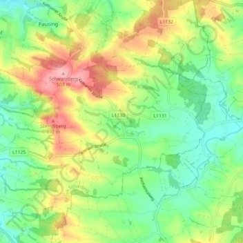
Nombre: Mapa topográfico Altschwendt, altitud, relieve.
Altitud media: 423 m
Altitud mínima: 373 m
Altitud máxima: 499 m
Altschwendt liegt auf 432 m Höhe im Innviertel. Die Ausdehnung beträgt von Nord nach Süd 6,5 km, von West nach Ost 4 km. Die Gesamtfläche beträgt 12,7 km². 12,6 % der Fläche sind bewaldet, 79,5 % der Fläche sind landwirtschaftlich genutzt.