
Mapa topográfico Pedoulas
Mapa interactivo
Haga clic en el mapa para ver la altitud.
Pedoulas
Pedoulas (Greek: Πεδουλάς) is a village in the Nicosia District of Cyprus, located at an altitude of 1,100 metres (3,600 ft) in the Troodos Mountains, 4 km south of Moutoullas. It lies in Marathasa Valley. The name is derived from the words pediada (valley) and laos (people). It is popular summer resort.
Acerca de este mapa
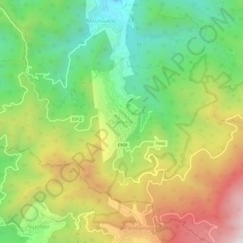
Nombre: Mapa topográfico Pedoulas, altitud, relieve.
Lugar: Pedoulas, Nicosia District, Cyprus, 2850, Cyprus (34.94739 32.80877 34.98739 32.84877)
Altitud media: 1.142 m
Altitud mínima: 699 m
Altitud máxima: 1.742 m