
Mapa topográfico Mount Scenery
Mapa interactivo
Haga clic en el mapa para ver la altitud.
Mount Scenery
Mount Scenery is an active volcano in the Caribbean Netherlands. Its lava dome forms the summit of the Saba island stratovolcano. At an elevation of 887 m (2,910 ft), it is the highest point in both the Kingdom of the Netherlands, and, since the dissolution of the Netherlands Antilles on 10 October 2010, the highest point in the Netherlands proper.
Acerca de este mapa
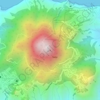
Nombre: Mapa topográfico Mount Scenery, altitud, relieve.
Lugar: Mount Scenery, Windwardside, Saba, Netherlands (17.63402 -63.23702 17.63412 -63.23692)
Altitud media: 339 m
Altitud mínima: 0 m
Altitud máxima: 847 m