
Mapa topográfico South Taft
Mapa interactivo
Haga clic en el mapa para ver la altitud.
Acerca de este mapa
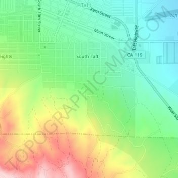
Nombre: Mapa topográfico South Taft, altitud, relieve.
Lugar: South Taft, Taft, Kern County, California, United States (35.12245 -119.47272 35.13691 -119.44730)
Altitud media: 343 m
Altitud mínima: 249 m
Altitud máxima: 502 m
South Taft is a census-designated place (CDP) in Kern County, California, United States. South Taft is located 0.5 miles (0.8 km) south of Taft, at an elevation of 1,017 feet (310 m). The population was 2,169 at the 2010 census, up from 1,898 at the time of the 2000 census.