
Mapa topográfico Wheeling
Mapa interactivo
Haga clic en el mapa para ver la altitud.
Acerca de este mapa
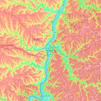
Nombre: Mapa topográfico Wheeling, altitud, relieve.
Lugar: Wheeling, Ohio County, West Virginia, 26003, United States (39.90396 -80.88091 40.22396 -80.56091)
Altitud media: 326 m
Altitud mínima: 187 m
Altitud máxima: 436 m
Otros mapas topográficos
Haga clic en un mapa para ver su topografía, su altitud y su relieve.
Echo Point
United States > West Virginia > Ohio County > Wheeling
Echo Point, Wheeling, Ohio County, West Virginia, 26003, United States
Altitud media: 293 m
Pleasant Valley
United States > West Virginia > Ohio County > Wheeling > Pleasant Valley
Pleasant Valley, Wheeling, Ohio County, West Virginia, 26003, United States
Altitud media: 284 m