
Mapa topográfico Solferino
Mapa interactivo
Haga clic en el mapa para ver la altitud.
Solferino
The municipal territory, extending for 13.08 km2, is part of the Morainic amphitheatre of Lake Garda, located a few kilometres to the north. The altitude at the town hall is 124 m above sea level. Not far away also lies the province of Verona, with the towns of Peschiera del Garda and Valeggio sul Mincio, only a few kilometres to the east.
Acerca de este mapa
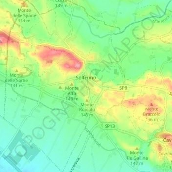
Nombre: Mapa topográfico Solferino, altitud, relieve.
Lugar: Solferino, Mantua, Lombardy, 46040, Italy (45.34248 10.53443 45.38982 10.58191)
Altitud media: 119 m
Altitud mínima: 77 m
Altitud máxima: 198 m
Otros mapas topográficos
Haga clic en un mapa para ver su topografía, su altitud y su relieve.
Castiglione delle Stiviere
Italy > Lombardy > Mantua > Castiglione delle Stiviere > Castiglione delle Stiviere
Altitud media: 107 m