
Mapa topográfico Long Pine Lake
Mapa interactivo
Haga clic en el mapa para ver la altitud.
Acerca de este mapa
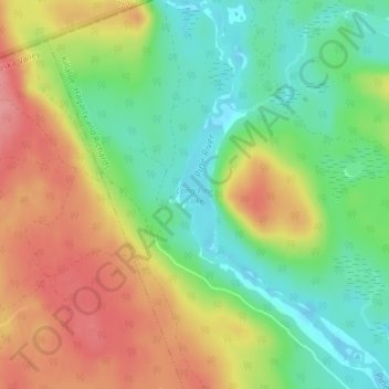
Nombre: Mapa topográfico Long Pine Lake, altitud, relieve.
Altitud media: 221 m
Altitud mínima: 175 m
Altitud máxima: 275 m
Otros mapas topográficos
Haga clic en un mapa para ver su topografía, su altitud y su relieve.
Bonnechere Provincial Park
Canada > Ontario > Killaloe, Hagarty and Richards
Bonnechere Provincial Park, Round Lake Road, Killaloe, Hagarty and Richards, Renfrew County, Ontario, Canada
Altitud media: 175 m