
Mapa topográfico Lake Nakuru
Mapa interactivo
Haga clic en el mapa para ver la altitud.
Lake Nakuru
Lake Nakuru is one of the Rift Valley soda lakes at an elevation of 1,754 m (5,755 ft) above sea level. It lies to the south of Nakuru, in the rift valley of Kenya and is protected by Lake Nakuru National Park.
Acerca de este mapa
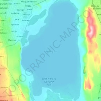
Nombre: Mapa topográfico Lake Nakuru, altitud, relieve.
Lugar: Lake Nakuru, Kaloleni, Nakuru, Kenya (-0.40762 36.05632 -0.30774 36.11811)
Altitud media: 1.807 m
Altitud mínima: 1.754 m
Altitud máxima: 2.095 m