
Mapa topográfico Oymyakon
Mapa interactivo
Haga clic en el mapa para ver la altitud.
Acerca de este mapa
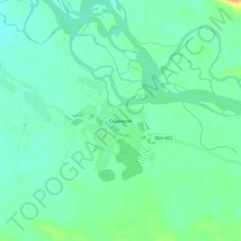
Nombre: Mapa topográfico Oymyakon, altitud, relieve.
Altitud media: 679 m
Altitud mínima: 670 m
Altitud máxima: 704 m
With an extreme subarctic climate (Köppen climate classification Dfd), Oymyakon is known as one of the places considered the Northern Pole of Cold, the other being the town of Verkhoyansk, located 629 km (391 mi) away by air. The weather station is in a valley between Oymyakon and Tomtor. The station is at 750 m (2,460 ft) above sea level and the surrounding mountains, at 1,100 m (3,600 ft), cause cold air to pool in the valley: in fact, recent studies show that winter temperatures in the area increase with altitude by as much as 10 °C (18 °F). The ground is permanently frozen (continuous permafrost).
Otros mapas topográficos
Haga clic en un mapa para ver su topografía, su altitud y su relieve.
Nera River
Russia > Sakha Republic > Oymyakonsky Ulus
Nera River, городское поселение Усть-Нера, Oymyakonsky Ulus, Sakha Republic, Far Eastern Federal District, Russia
Altitud media: 509 m
Delyankir
Russia > Sakha Republic > Oymyakonsky Ulus
Delyankir, городское поселение Артык, Oymyakonsky Ulus, Sakha Republic, Far Eastern Federal District, Russia
Altitud media: 812 m
Орто-Балаган
Russia > Sakha Republic > Oymyakonsky Ulus
Орто-Балаган, Сордоннохский наслег, Oymyakonsky Ulus, Sakha Republic, Far Eastern Federal District, Russia
Altitud media: 772 m
Ust-Nera
Russia > Sakha Republic > Oymyakonsky Ulus
Ust-Nera, городское поселение Усть-Нера, Oymyakonsky Ulus, Sakha Republic, Far Eastern Federal District, 678730, Russia
Altitud media: 646 m