
Mapa topográfico Little Down
Mapa interactivo
Haga clic en el mapa para ver la altitud.
Acerca de este mapa
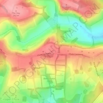
Nombre: Mapa topográfico Little Down, altitud, relieve.
Altitud media: 211 m
Altitud mínima: 146 m
Altitud máxima: 263 m
Otros mapas topográficos
Haga clic en un mapa para ver su topografía, su altitud y su relieve.
Ashmore Pond
United Kingdom > England > Wiltshire > Chute
Ashmore Pond, Chute, Wiltshire, England, United Kingdom
Altitud media: 205 m