
Mapa topográfico Ingham Mills
Mapa interactivo
Haga clic en el mapa para ver la altitud.
Acerca de este mapa
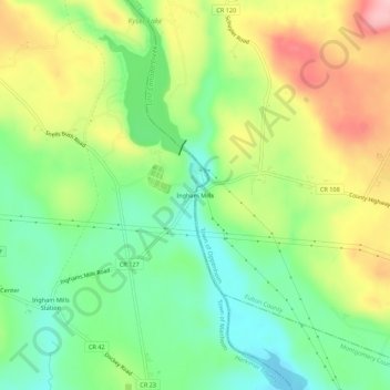
Nombre: Mapa topográfico Ingham Mills, altitud, relieve.
Altitud media: 215 m
Altitud mínima: 147 m
Altitud máxima: 312 m
Otros mapas topográficos
Haga clic en un mapa para ver su topografía, su altitud y su relieve.
East Creek
United States > New York > Herkimer County > Town of Manheim
East Creek, Town of Manheim, Herkimer County, New York, United States
Altitud media: 139 m
Ingham Mills Station
United States > New York > Herkimer County > Town of Manheim
Ingham Mills Station, Town of Manheim, Herkimer County, New York, United States
Altitud media: 189 m
Manheim Center
United States > New York > Herkimer County > Town of Manheim
Manheim Center, Town of Manheim, Herkimer County, New York, United States
Altitud media: 196 m