
Mapa topográfico Emberton Country Park
Mapa interactivo
Haga clic en el mapa para ver la altitud.
Acerca de este mapa
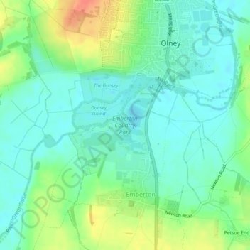
Nombre: Mapa topográfico Emberton Country Park, altitud, relieve.
Altitud media: 59 m
Altitud mínima: 44 m
Altitud máxima: 90 m
Otros mapas topográficos
Haga clic en un mapa para ver su topografía, su altitud y su relieve.
Emberton
United Kingdom > England > Emberton
Emberton, South East, England, MK46 5BX, United Kingdom
Altitud media: 69 m