
Mapa topográfico Huis ter Heide
Mapa interactivo
Haga clic en el mapa para ver la altitud.
Acerca de este mapa
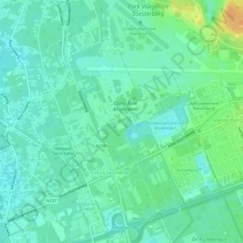
Nombre: Mapa topográfico Huis ter Heide, altitud, relieve.
Lugar: Huis ter Heide, Zeist, Utrecht, Niederlande (52.10498 5.24325 52.13638 5.28234)
Altitud media: 13 m
Altitud mínima: 3 m
Altitud máxima: 36 m
Otros mapas topográficos
Haga clic en un mapa para ver su topografía, su altitud y su relieve.