
Mapa topográfico Tangstedt
Mapa interactivo
Haga clic en el mapa para ver la altitud.
Acerca de este mapa
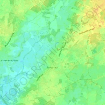
Nombre: Mapa topográfico Tangstedt, altitud, relieve.
Altitud media: 11 m
Altitud mínima: 1 m
Altitud máxima: 25 m
Otros mapas topográficos
Haga clic en un mapa para ver su topografía, su altitud y su relieve.
Heist
Duitsland > Sleeswijk-Holstein > Kreis Pinneberg
Heist, Geest und Marsch Südholstein, Kreis Pinneberg, Sleeswijk-Holstein, 25492, Duitsland
Altitud media: 6 m