
Mapa topográfico Kemsing
Haga clic en el mapa para ver la altitud.
Acerca de este mapa
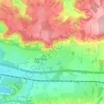
Nombre: Mapa topográfico Kemsing, altitud, relieve.
Lugar: Kemsing, Sevenoaks, Kent, England, United Kingdom (51.29554 0.20294 51.32191 0.26813)
Altitud media: 139 m
Altitud mínima: 62 m
Altitud máxima: 234 m
Otros mapas topográficos
Haga clic en un mapa para ver su topografía, su altitud y su relieve.
Knatts Valley
United Kingdom > England > Kent > Sevenoaks > East Hill > Knockmill
Altitud media: 170 m