
Mapa topográfico Shanksville
Mapa interactivo
Haga clic en el mapa para ver la altitud.
Acerca de este mapa
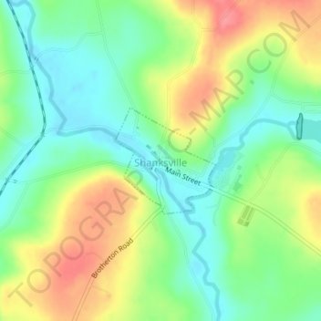
Nombre: Mapa topográfico Shanksville, altitud, relieve.
Altitud media: 702 m
Altitud mínima: 670 m
Altitud máxima: 749 m
Shanksville is located at 40°1′2″N 78°54′21″W / 40.01722°N 78.90583°W / 40.01722; -78.90583 (40.017182, -78.905891), with the borough covering 0.2 square mile (0.5 km2), all land; it also has the seventh-highest elevation of boroughs in Pennsylvania at 2,230 feet (680 m).