
Gracias por apoyar a este sitio ❤️
Haz una donación
Haz una donación
Mapa topográfico Trebur
Haga clic en el mapa para ver la altitud.
Gracias por apoyar a este sitio ❤️
Haz una donación
Haz una donación
Trebur
Die Statistisch-topographisch-historische Beschreibung des Großherzogthums Hessen berichtet 1829 über Trebur.
Gracias por apoyar a este sitio ❤️
Haz una donación
Haz una donación
Acerca de este mapa
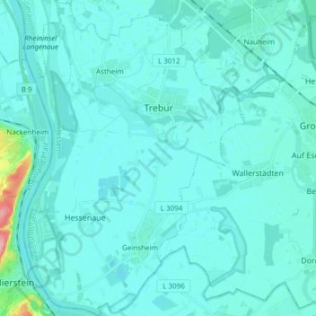
Nombre: Mapa topográfico Trebur, altitud, relieve.
Lugar: Trebur, Kreis Groß-Gerau, Hessen, 65468, Deutschland (49.86080 8.34097 49.95803 8.44676)
Altitud media: 93 m
Altitud mínima: 79 m
Altitud máxima: 195 m
Gracias por apoyar a este sitio ❤️
Haz una donación
Haz una donación
Otros mapas topográficos
Haga clic en un mapa para ver su topografía, su altitud y su relieve.