
Mapa topográfico State University of New York at Binghamton
Mapa interactivo
Haga clic en el mapa para ver la altitud.
Acerca de este mapa
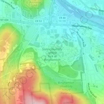
Nombre: Mapa topográfico State University of New York at Binghamton, altitud, relieve.
Altitud media: 320 m
Altitud mínima: 246 m
Altitud máxima: 482 m
Otros mapas topográficos
Haga clic en un mapa para ver su topografía, su altitud y su relieve.
Kopernik Observatory & Science Center
United States > New York > Broome County > Town of Vestal > Tracy Creek
Kopernik Observatory & Science Center, 698, Underwood Road, Tracy Creek, Town of Vestal, Broome County, New York, 13850, United States
Altitud media: 452 m
Ross Corners
United States > New York > Broome County > Town of Vestal
Ross Corners, Town of Vestal, Broome County, New York, United States
Altitud media: 304 m