
Mapa topográfico Bay of Fundy
Mapa interactivo
Haga clic en el mapa para ver la altitud.
Acerca de este mapa
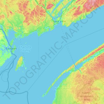
Nombre: Mapa topográfico Bay of Fundy, altitud, relieve.
Altitud media: 70 m
Altitud mínima: -3 m
Altitud máxima: 514 m
Otros mapas topográficos
Haga clic en un mapa para ver su topografía, su altitud y su relieve.
Saint John
Kanada > Neubraunschweig > Saint John
Saint John, City of Saint John, Saint John County, Neubraunschweig, E2L 3L6, Kanada
Altitud media: 44 m
Saint John
Kanada > Neubraunschweig > Saint John
Saint John, Saint John County, Neubraunschweig, Kanada
Altitud media: 39 m