
Gracias por apoyar a este sitio ❤️
Haz una donación
Haz una donación
Mapa topográfico St. John's in the Vale
Haga clic en el mapa para ver la altitud.
Gracias por apoyar a este sitio ❤️
Haz una donación
Haz una donación
Acerca de este mapa
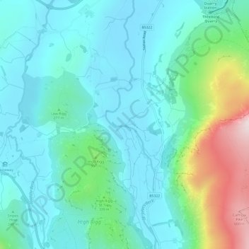
Nombre: Mapa topográfico St. John's in the Vale, altitud, relieve.
Altitud media: 256 m
Altitud mínima: 134 m
Altitud máxima: 706 m
Gracias por apoyar a este sitio ❤️
Haz una donación
Haz una donación
Otros mapas topográficos
Haga clic en un mapa para ver su topografía, su altitud y su relieve.