
Haz una donación
Mapa topográfico Eagle Bend Island Park
Haga clic en el mapa para ver la altitud.
Haz una donación
Acerca de este mapa
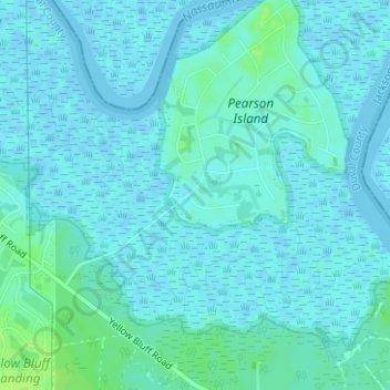
Nombre: Mapa topográfico Eagle Bend Island Park, altitud, relieve.
Altitud media: 3 m
Altitud mínima: -2 m
Altitud máxima: 11 m
Haz una donación
Otros mapas topográficos
Haga clic en un mapa para ver su topografía, su altitud y su relieve.
Saint Nicholas
United States > Florida > Duval County > Jacksonville > South Jacksonville
Altitud media: 6 m
Haz una donación
Haz una donación
Haz una donación
Haz una donación
Jacksonville
United States > Florida > Duval County > Jacksonville
Just south of Jacksonville and north of Saint Augustine is the boundary of where the Floridian Peninsula ends and Continental North America begins; Jacksonville is north of that line. While still in the North American Coastal plain, the topography begins to take on slight Piedmont characteristics. Like the…
Altitud media: 9 m
Haz una donación
Haz una donación
Haz una donación
Haz una donación
Dutton Island Preserve
United States > Florida > Duval County > Jacksonville > Oak Harbor
Altitud media: 2 m
Haz una donación
Haz una donación
Haz una donación
Haz una donación
Haz una donación
Haz una donación
Haz una donación
Haz una donación
Haz una donación