
Gracias por apoyar a este sitio ❤️
Haz una donación
Haz una donación
Mapa topográfico Ipatinga
Haga clic en el mapa para ver la altitud.
Gracias por apoyar a este sitio ❤️
Haz una donación
Haz una donación
Ipatinga
In 1956, a Japanese commission visited the then-district of Ipatinga, selecting it as the site for the Usiminas steel plant. Factors influencing this decision included suitable topography, proximity to raw material sources and consumer markets, availability of water resources, abundant electricity, local railway infrastructure, and proximity to other steelmaking centers. News of the steel plant's construction attracted many new residents even before its establishment, necessitating urban planning for the city.
Gracias por apoyar a este sitio ❤️
Haz una donación
Haz una donación
Acerca de este mapa
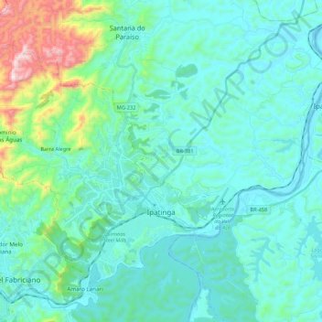
Nombre: Mapa topográfico Ipatinga, altitud, relieve.
Altitud media: 329 m
Altitud mínima: 200 m
Altitud máxima: 1.035 m
Gracias por apoyar a este sitio ❤️
Haz una donación
Haz una donación