
Mapa topográfico Hasborn-Dautweiler
Mapa interactivo
Haga clic en el mapa para ver la altitud.
Acerca de este mapa
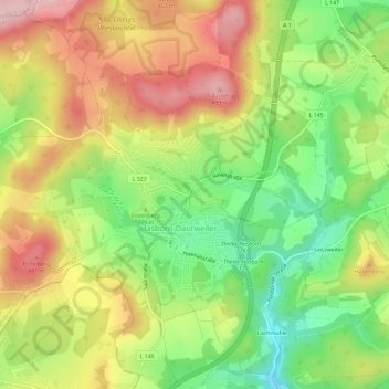
Nombre: Mapa topográfico Hasborn-Dautweiler, altitud, relieve.
Altitud media: 389 m
Altitud mínima: 283 m
Altitud máxima: 502 m
Otros mapas topográficos
Haga clic en un mapa para ver su topografía, su altitud y su relieve.
Theley
Deutschland > Saarland > Tholey
Theley, Tholey, Landkreis St. Wendel, Saarland, Deutschland
Altitud media: 390 m
Neipel
Deutschland > Saarland > Tholey
Neipel, Tholey, Landkreis St. Wendel, Saarland, Deutschland
Altitud media: 352 m