
Mapa topográfico Lake of the Pines
Mapa interactivo
Haga clic en el mapa para ver la altitud.
Acerca de este mapa
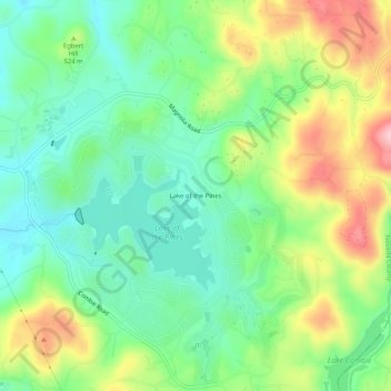
Nombre: Mapa topográfico Lake of the Pines, altitud, relieve.
Lugar: Lake of the Pines, Nevada County, California, 95722, USA (39.01962 -121.07661 39.05962 -121.03661)
Altitud media: 505 m
Altitud mínima: 434 m
Altitud máxima: 630 m