
Mapa topográfico Storthes Hall Park Campus
Mapa interactivo
Haga clic en el mapa para ver la altitud.
Acerca de este mapa
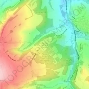
Nombre: Mapa topográfico Storthes Hall Park Campus, altitud, relieve.
Altitud media: 173 m
Altitud mínima: 85 m
Altitud máxima: 275 m
Otros mapas topográficos
Haga clic en un mapa para ver su topografía, su altitud y su relieve.
Thunderbridge
United Kingdom > England > Kirklees > Kirkburton
Thunderbridge, Kirkburton, Stocksmoor, Kirklees, West Yorkshire, England, HD8 0PX, United Kingdom
Altitud media: 188 m