

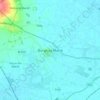
Mapa topográfico Boston
Haga clic en el mapa para ver la altitud.
Acerca de este mapa

Nombre: Mapa topográfico Boston, altitud, relieve.
Altitud media: 3 m
Altitud mínima: -2 m
Altitud máxima: 14 m
Otros mapas topográficos
Haga clic en un mapa para ver su topografía, su altitud y su relieve.



Quarrington
United Kingdom > England > Lincolnshire > North Kesteven
According to the Köppen classification, the British Isles experience a maritime climate characterised by relatively cool summers and mild winters. Lincolnshire's position on the east of the Isles allows for a sunnier and warmer climate relative to the national average, and it is one of the driest counties in…
Altitud media: 21 m


Little Haw Wood
United Kingdom > England > Lincolnshire > South Kesteven > Castle Bytham
Altitud media: 92 m

Lincoln
United Kingdom > England > Lincolnshire
Lincoln lies at an altitude of 67 ft (20.4 m) by the River Witham up to 246 ft (75.0 m) on Castle Hill. It fills a gap in the Lincoln Cliff escarpment, which runs north and south through Central Lincolnshire, with altitudes up to 200 feet (61 metres). The city lies on the River Witham, which flows through this…
Altitud media: 21 m










Caen Hill
United Kingdom > England > Lincolnshire > West Lindsey > Great Limber CP
Altitud media: 83 m

Holbeach Clough
United Kingdom > England > Lincolnshire > South Holland > Holbeach CP > Saracen's Head
Altitud media: 4 m
Moor Barn
United Kingdom > England > Lincolnshire > South Kesteven > Hough-on-the-Hill
Altitud media: 31 m


Threekingham
United Kingdom > England > Lincolnshire > North Kesteven > Threekingham
Altitud media: 30 m


Witham on the Hill
United Kingdom > England > Lincolnshire > South Kesteven > Witham on the Hill
Altitud media: 43 m

Kirkby Fenside
United Kingdom > England > Lincolnshire > East Lindsey > East Kirkby
Altitud media: 12 m

Roughton Moor
United Kingdom > England > Lincolnshire > East Lindsey > Kirkby on Bain > Roughton
Altitud media: 23 m










Grimsthorpe
United Kingdom > England > Lincolnshire > South Kesteven > Grimsthorpe
Altitud media: 55 m

Old Somerby
United Kingdom > England > Lincolnshire > South Kesteven > Old Somerby
Altitud media: 115 m




Sutton le Marsh
United Kingdom > England > Lincolnshire > East Lindsey > Sutton-on-Sea > Sutton le Marsh
Altitud media: 1 m


Low Hameringham
United Kingdom > England > Lincolnshire > East Lindsey > Low Hameringham
Altitud media: 72 m
Poolham
United Kingdom > England > Lincolnshire > East Lindsey > Horsington > Poolham
Altitud media: 18 m
