
Mapa topográfico Lake Louise
Mapa interactivo
Haga clic en el mapa para ver la altitud.
Acerca de este mapa
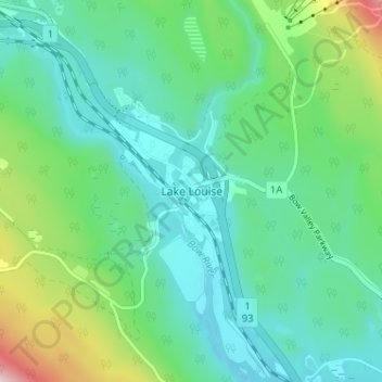
Nombre: Mapa topográfico Lake Louise, altitud, relieve.
Lugar: Lake Louise, Alberta, Kanada (51.40497 -116.19754 51.44497 -116.15754)
Altitud media: 1.617 m
Altitud mínima: 1.518 m
Altitud máxima: 1.934 m
Otros mapas topográficos
Haga clic en un mapa para ver su topografía, su altitud y su relieve.
Lake Louise
Kanada > Alberta > Lake Louise
Lake Louise, Plain of the 6 Glaciers Trail, Lake Louise, Improvement District No. 9, Alberta, Kanada
Altitud media: 1.984 m