
Gracias por apoyar a este sitio ❤️
Haz una donación
Haz una donación
Mapa topográfico Pellheim
Haga clic en el mapa para ver la altitud.
Gracias por apoyar a este sitio ❤️
Haz una donación
Haz una donación
Acerca de este mapa
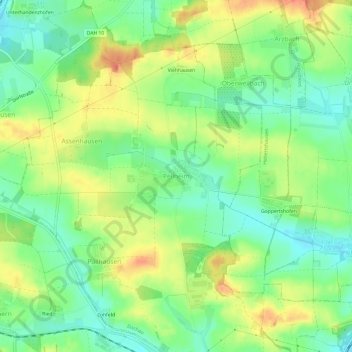
Nombre: Mapa topográfico Pellheim, altitud, relieve.
Lugar: Pellheim, Dachau, Landkreis Dachau, Bayern, 85244, Deutschland (48.27487 11.39691 48.31487 11.43691)
Altitud media: 503 m
Altitud mínima: 478 m
Altitud máxima: 535 m
Gracias por apoyar a este sitio ❤️
Haz una donación
Haz una donación