
Mapa topográfico Morrow Mountain State Park
Mapa interactivo
Haga clic en el mapa para ver la altitud.
Morrow Mountain State Park
Morrow Mountain is one of the highest peaks in the Uwharrie Mountains of central North Carolina. When first formed, these mountains rose to nearly 20,000 feet (6,100 m) above sea level, but erosion has gradually worn them down to little more than high hills that average less than 1,000 feet (300 m) in elevation. These pinnacles are the remains of one of the oldest mountain ranges in the eastern United States. The park contains several peaks, of which Morrow Mountain is a high point at 936 feet (285 m).
Acerca de este mapa
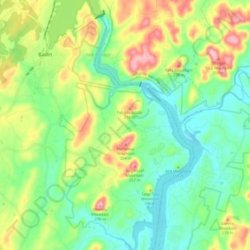
Nombre: Mapa topográfico Morrow Mountain State Park, altitud, relieve.
Altitud media: 151 m
Altitud mínima: 84 m
Altitud máxima: 272 m
Otros mapas topográficos
Haga clic en un mapa para ver su topografía, su altitud y su relieve.
Forest Drive
United States > North Carolina > Stanly County > Albemarle > Forest Drive
Altitud media: 166 m