
Haz una donación
Mapa topográfico Laranjal do Jari
Haga clic en el mapa para ver la altitud.
Haz una donación
Acerca de este mapa
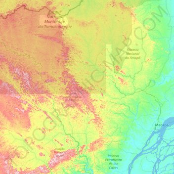
Nombre: Mapa topográfico Laranjal do Jari, altitud, relieve.
Altitud media: 167 m
Altitud mínima: -6 m
Altitud máxima: 671 m
Haz una donación
Otros mapas topográficos
Haga clic en un mapa para ver su topografía, su altitud y su relieve.
Amazon River
During what many archaeologists called the formative stage, Amazonian societies were deeply involved in the emergence of South America's highland agrarian systems. The trade with Andean civilizations in the terrains of the headwaters in the Andes formed an essential contribution to the social and religious…
Altitud media: 10 m
Haz una donación