
Mapa topográfico Marlow
Mapa interactivo
Haga clic en el mapa para ver la altitud.
Acerca de este mapa
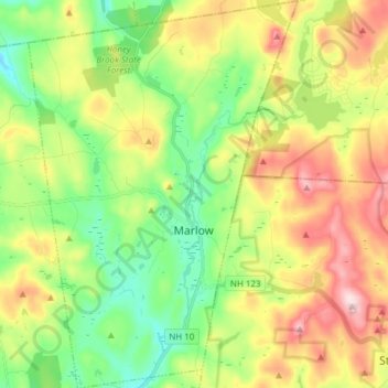
Nombre: Mapa topográfico Marlow, altitud, relieve.
Altitud media: 446 m
Altitud mínima: 311 m
Altitud máxima: 648 m
According to the United States Census Bureau, the town has a total area of 26.4 square miles (68 km2), of which 26.0 sq mi (67 km2) is land and 0.5 sq mi (1.3 km2) is water, comprising 1.78% of the town. Marlow is drained by the Ashuelot River. The town's highest point is in its northeast corner, at the summit of Huntley Mountain, where the elevation reaches 1,978 feet (603 m) above sea level.