
Mapa topográfico Altmärkische Höhe
Mapa interactivo
Haga clic en el mapa para ver la altitud.
Acerca de este mapa
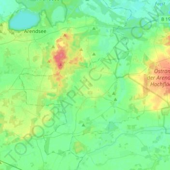
Nombre: Mapa topográfico Altmärkische Höhe, altitud, relieve.
Altitud media: 33 m
Altitud mínima: 18 m
Altitud máxima: 71 m
Altmärkische Höhe ist eine kreisangehörige Gemeinde in der Verbandsgemeinde Seehausen (Altmark) im Landkreis Stendal in Sachsen-Anhalt.