
Mapa topográfico Glasgow
Mapa interactivo
Haga clic en el mapa para ver la altitud.
Glasgow
According to the United States Census Bureau, the city has a total area of 1.43 square miles (3.7 km2), all of it land. The town has an elevation of 2,093 feet (638 m) and is nestled in the Milk River Valley.
Acerca de este mapa
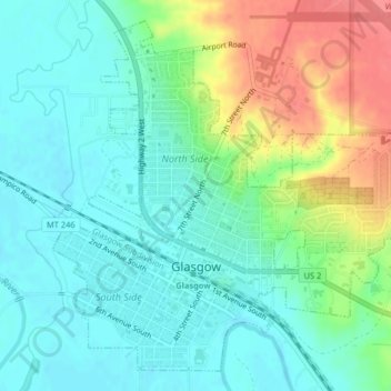
Nombre: Mapa topográfico Glasgow, altitud, relieve.
Lugar: Glasgow, Valley County, Montana, 59230, United States (48.18836 -106.65042 48.21255 -106.61272)
Altitud media: 654 m
Altitud mínima: 633 m
Altitud máxima: 700 m