
Mapa topográfico Crayke
Mapa interactivo
Haga clic en el mapa para ver la altitud.
Crayke
The village is at an elevation of 368 feet (112 m) at its highest point. The nearest settlements are Easingwold 2.51 miles (4.04 km) to the south-west; Stillington 2.1 miles (3.4 km) to the south-east; Brandsby 2 miles (3.2 km) to the north-east and Oulston 2.8 miles (4.5 km) to the north. The River Foss lies just 1 mile (1.6 km) to the east of the village.
Acerca de este mapa
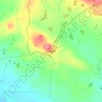
Nombre: Mapa topográfico Crayke, altitud, relieve.
Altitud media: 58 m
Altitud mínima: 25 m
Altitud máxima: 118 m