
Mapa topográfico High Hatton
Mapa interactivo
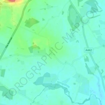
Haga clic en el mapa para ver la altitud.
Acerca de este mapa
Nombre: Mapa topográfico High Hatton, altitud, relieve.
Altitud media: 75 m
Altitud mínima: 61 m
Altitud máxima: 138 m
Otros mapas topográficos
Haga clic en un mapa para ver su topografía, su altitud y su relieve.
River Roden
United Kingdom > England > Shropshire > Stanton upon Hine Heath
River Roden, Stanton upon Hine Heath, Shropshire, England, United Kingdom
Altitud media: 80 m