
Mapa topográfico Tangail
Mapa interactivo
Haga clic en el mapa para ver la altitud.
Acerca de este mapa
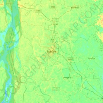
Nombre: Mapa topográfico Tangail, altitud, relieve.
Altitud media: 11 m
Altitud mínima: 2 m
Altitud máxima: 24 m
Tangail was a popular local business centre since the early 19th century. But the name came on focus when the headquarter of a subdivision of the Greater Mymensingh District was shifted in 1860 from Atia to there due to its fertility and high elevation near Louhajong River. At the same time, The subdivision was named as Tangail.