
Mapa topográfico Port Townsend
Mapa interactivo
Haga clic en el mapa para ver la altitud.
Acerca de este mapa
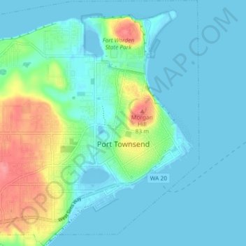
Nombre: Mapa topográfico Port Townsend, altitud, relieve.
Lugar: Port Townsend, Jefferson County, Washington, United States (48.09772 -122.81632 48.14630 -122.74714)
Altitud media: 19 m
Altitud mínima: -7 m
Altitud máxima: 90 m
Otros mapas topográficos
Haga clic en un mapa para ver su topografía, su altitud y su relieve.
Port Townsend
United States > Washington > Jefferson County > Port Townsend > Port Townsend
Altitud media: 18 m
Mount Olympus
United States > Washington > Jefferson County
With notable local relief, Mount Olympus ascends over 2,100 m (6,900 ft) from the 293 m (961 ft) elevation confluence of the Hoh River with Glacier Creek in only 8.8 km (5.5 mi). Mount Olympus has 2,386 m (7,828 ft) of prominence, ranking 5th in the state of Washington.
Altitud media: 1.934 m