
Mapa topográfico Guntur
Mapa interactivo
Haga clic en el mapa para ver la altitud.
Guntur
Guntur is located at 16°17′N 80°26′E / 16.29°N 80.43°E / 16.29; 80.43. It has an average elevation of 33 m (108 ft) and is situated on the plains. There are few hills in the surrounding suburban areas and Perecherla Reserve Forest on the north west. The city is around 64 km (40 mi) to the west of the Bay of Bengal on the east coast of India. The Krishna delta lies partly in the Guntur district. There are other smaller rivers and channels in the region such as Guntur Channel, Chandravanka, Naagileru, Guntur Branch Canal etc.
Acerca de este mapa
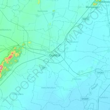
Nombre: Mapa topográfico Guntur, altitud, relieve.
Lugar: Guntur, Andhra Pradesh, 522001, India (16.13152 80.29416 16.45152 80.61416)
Altitud media: 29 m
Altitud mínima: 6 m
Altitud máxima: 474 m
Otros mapas topográficos
Haga clic en un mapa para ver su topografía, su altitud y su relieve.