
Mapa topográfico Aizawl
Mapa interactivo
Haga clic en el mapa para ver la altitud.
Acerca de este mapa
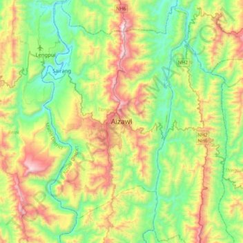
Nombre: Mapa topográfico Aizawl, altitud, relieve.
Lugar: Aizawl, Tlangnuam, Aizwal District, Mizoram, 796190, India (23.58335 92.57828 23.90335 92.89828)
Altitud media: 556 m
Altitud mínima: 60 m
Altitud máxima: 1.509 m
Aizawl has a mild, sub-tropical climate due to its location and elevation. Under the Köppen climate classification, Aizawl features a humid subtropical climate (Cwa). In summer, temperatures are moderately warm, averaging around 20–30 °C (68–86 °F). In winter, daytime temperatures are cooler in comparison to the rest of the year, averaging around 11–21 °C (52–70 °F). Rainfall is mostly concentrated between April and October, with the heaviest rainfall occurring in May, July, August and September. The remainder of the year is notably drier.